D rone flights
Your very own drone recordings!
Discover new perspectives from a bird’s eye view, gain new insights and present your region, highlights or construction projects.
FACTS
- 360° spherical panorama – also in virtual reality (VR)
- Aerial photography
- Marketing videos (including post-production, opening credits, and royalty-free music)
- Orthophotos, digital surface models, 3D models (also for the construction industry)
- Editing of the data
- Hosting of the data with and without password protection
- we take care of the flight permit
Construction sector:
Inform about the construction progress inside and outside your company. Aerial photos give you and your customers a good overview of the project progress and the surrounding area. High-resolution orthophotos, digital surface models and 3D point clouds support you in displaying complex surface structures. Use an image video for your digital marketing at the end of the construction phase.
The drone recordings can also be integrated into a premium time-lapse film.
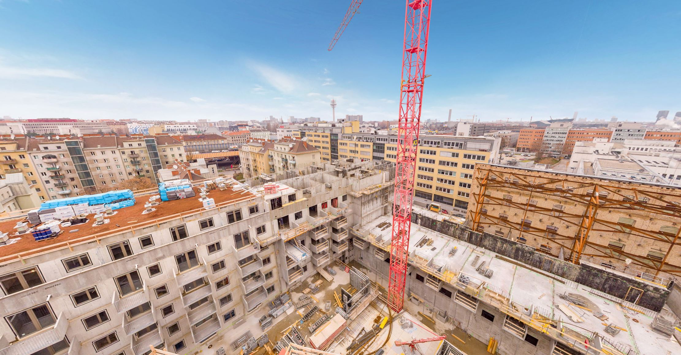
Link: Construction drone panorama
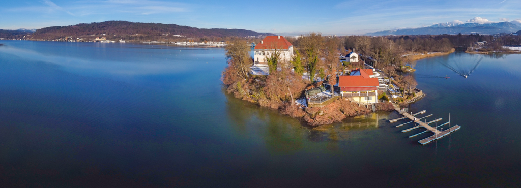
Tourism:
Present your region spectacularly from above. Fascinate your guests with unique aerial photographs and arouse their curiosity with videos from a bird’s eye view. Create desire to go on a holiday trip.
Present your region spectacularly from above. Fascinate your guests with unique aerial photographs and arouse their curiosity with videos from a bird’s eye view. Create desire to go on a holiday trip.
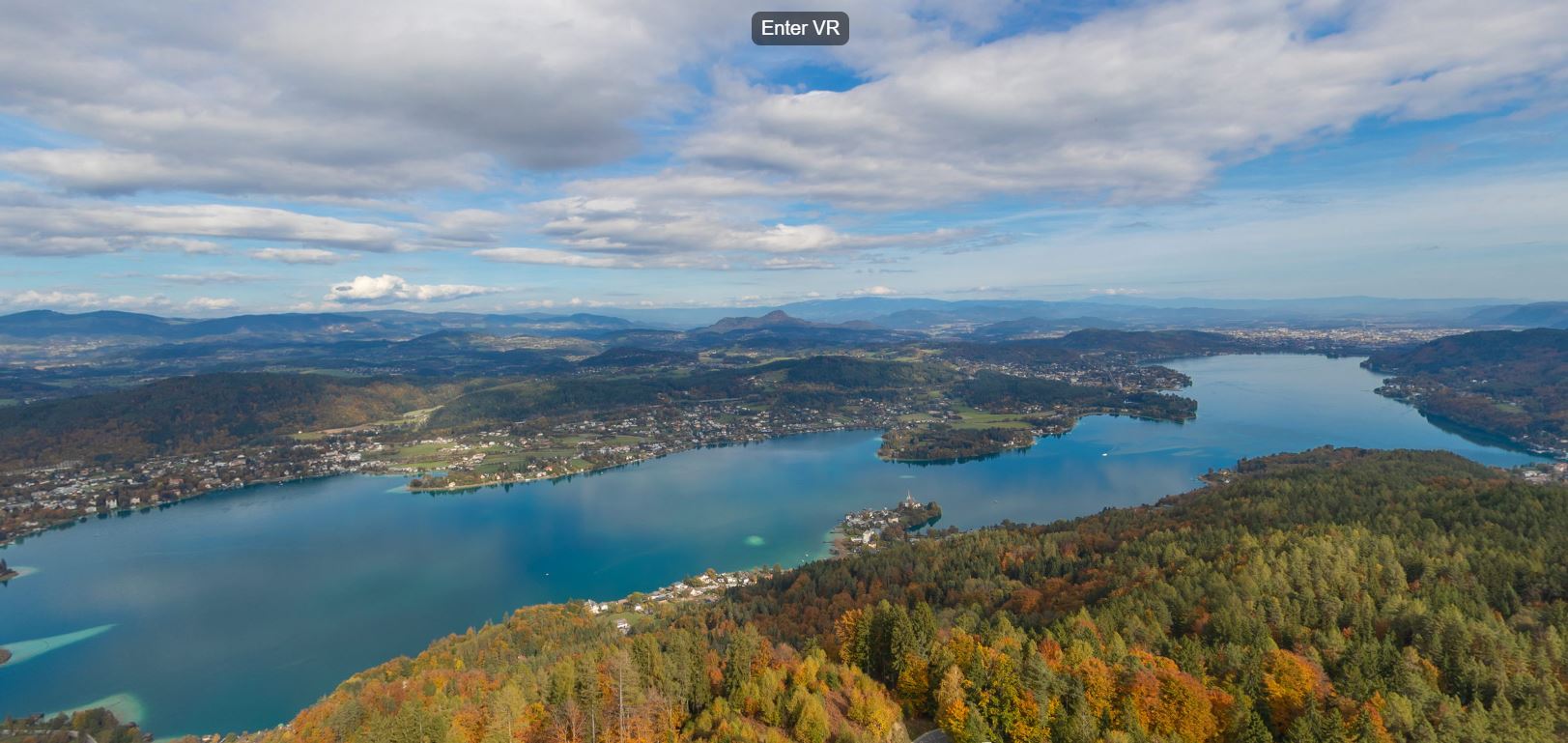
Link: Drone panorama with virtual reality
PRODUCT PACKAGES
Drone flight
- 15 aerial photos
- 1x 360° drone panorama
- including travel (outside the EU on request)
Drone flight with Video
- 15 aerial photos
- 1x 360° drone panorama
- 60-second drone video including editing and royalty-free music
- including travel (outside the EU on request)
Drone 3D Mapping
- high resolution single photos
- digital surface model
- GPS location
- high resolution orthophoto
- including travel (outside the EU on request)
VIDEOS